

Pilot Road University:
The Campus Wayfinding Application
Improve Student Retention and Space Efficiency
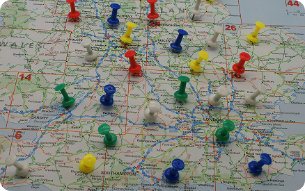
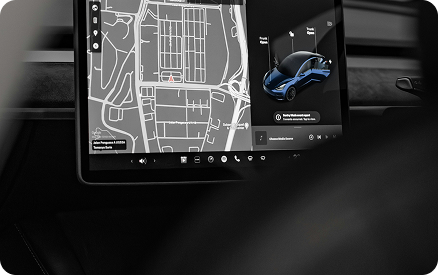
The Pilot Road University Guide is using the latest digital mapping and wayfinding technology to transform university facilities into interactive digital space. It helps in improving the visitor experience, staff satisfaction, and optimizing space utilization efficiency and availability. It is an easy-to-use solution for searching, navigating, and working across the campus – from the parking lot to the lecture hall. It also makes it possible to share location information as part of any internal and external communication.
The Pilot Road University Guide makes possible for seamless co-usage of the vast campus real estate. It has been developed together with leading universities to help in daily tasks that both the staff and the students have during a typical day. The solution has been successfully used by Finland’s largest university campus, where it has provided a simple to use space navigator to its students, staff, and corporate users. As a result, the utilization efficiency of the whole campus has increased without lowering the space availability nor experience.
The solution is used by more than 18 000 users today, in just one campus alone.
- Pinch/wheel to zoom
- Rotate
- 3D tilt with right-click
- Switch between floors using the floor selector on the right
- A quick search with category buttons
- Free dynamic text search
Interactive Floor Plans and Maps
- Convert outdoor and indoor spaces into colorful, digital, location-aware maps, and floorplans
- Search points of interests
- Edit maps and create searchable POI’s with Map Editor
- Use on your website and give immersive and useful experience for your visitors, students, and staff
- Navigate and get point-to-point walk instructions, with distance and arrival time estimates
- Publish service listings and their locations
- Share map links over SMS, social media or QR code
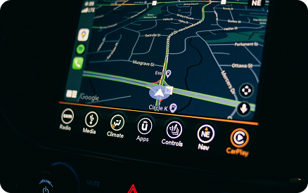
Indoor Wayfinding App for Mobile and Web
- Get point-to-point walk instructions to the destination
- Locate yourself using a smartphone with Google-style navigation indoor and outdoor
- Opt-in to share your real-time location with colleagues
- Gain situational awareness on whats happening at the campus by collecting locations of opted-in individuals overlaid with occupancy and other IoT data available.
Locate the Best Workspace for You
- Search and reserve workspace and meeting rooms .
- See live availability status for any space and room, with occupancy sensors & calendar status .
- Get space occupancy and utilization statistics over time .


Behavioral analytics
- See how your spaces are used
- Understand where people in need for spaces
- React to bottle necks based on actionable data.
- Have your campus to operate at its full potential, both in user experience and space efficiency!
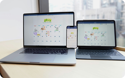
One Map – All Screens
- With Pilot Road, you can manage a single set of floorplans and points of interest and provide all users unified experience regardless what device they are using.
- Web browser: Interactive kioks, desktop, tablet, mobile
- Mobile: iOS, Android
- Print: High resolution map exports.
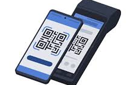
Engage with QR-codes
- QR code based location sharing
- Use QR codes on invitations, guides and digital signage
- Move effortlessly between kiosk and mobile using QR codes
Dynamic Map Styles
- Pilot Road supports traditional maps as well as modern dark theme styles. Choose the one that fits your brand and use case the best!

CAD to Interactive Maps
- Pilot Road map creation tools allow transforming of your existing AutoCAD and files to interactive building maps.
- Our team can help you create digital twin of your campus in less than a week of calendar time.
- Our tools automatically pick up all your room IDs in your buildings and makes them searchable through our Smart Campus interactive maps.
Powerful Floorplan and Map editor
- Pilot Road connects AutoCAD and other existing data sources into one simple to manage, open dataset. With powerful map management and publishing tools you maintain the operational data with ease.
Pilot Road Advantage
Pilot Road provides several functionalities on one platform, including interactive 3D maps, wayfinding, indoor positioning, space availability information, and room/space booking solutions.
Pilot Road gives the organization a single, up-to-date data set of the campus and eliminates the need to maintain siloed versions of the same data. Unlike any image-based mapping solutions, Pilot Road maps are directly connected to actual facility CAD drawings for easy updates. Integrate into existing systems. Thanks to the open nature of the platform, no vendor lock exists as all data is available through open APIs.
It gives students, staff, and visitors a seamless indoor-outdoor wayfinding experience before and during their campus visit. Embed maps as part of the campus website, use the Kiosk app in interactive displays, and QR-code/SMS based links for accessing the maps on mobile.